Inertial Measurement Unit (IMU) and Integrated Navigation in Drones: Applications and Industry Breakthroughs
Technological Foundation: Core Value of GNSS/INS Integrated Navigation
The Inertial Navigation System (INS) uses the Inertial Measurement Unit (IMU) to perceive real-time acceleration and angular velocity. As the core sensor of drones, IMU integrates triaxial accelerometers, gyroscopes, and magnetometers to capture body acceleration, angular velocity, and magnetic field data for flight control. However, its errors accumulate over time.
The Global Navigation Satellite System (GNSS) delivers centimeter-level absolute positioning but suffers from signal obstruction and electromagnetic interference. Through algorithms like Kalman filtering, GNSS and INS fuse complementarily: GNSS periodically corrects INS drift, while INS maintains short-term high-precision positioning during GNSS denial. This synergy enables stable navigation in complex environments, forming a “golden combination” for all-weather, full-scenario navigation and empowering drones with autonomous decision-making capabilities.
Divergent Applications: Fixed-Wing vs. Rotorcraft Drones
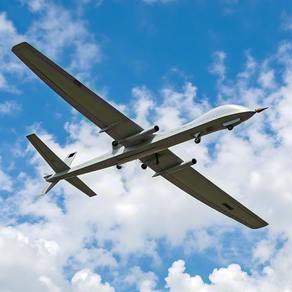
Fixed-Wing Drones: Precision Wing for Long-Endurance Missions
Leveraging aerodynamic efficiency, fixed-wing drones excel in surveying and inspection. Their navigation relies on GNSS-dominated systems with IMU-assisted dynamic attitude correction. For example, high-altitude long-endurance (HALE) drones use aerodynamic models to achieve centimeter-level positioning even during GNSS denial. Critical to this is IMU’s low-drift characteristic (e.g., gyro bias instability < 0.3°/h), minimizing cumulative errors over extended flights.
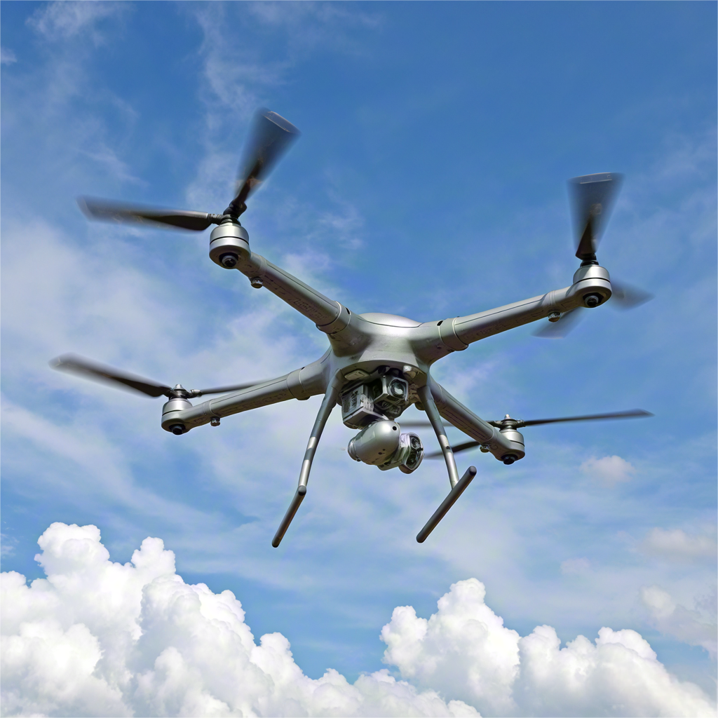
Rotorcraft Drones: Stability Pillar for Agile Operations
Rotorcraft drones depend on IMU’s real-time attitude feedback for hovering and agile maneuvers. DJI’s N3 flight controller exemplifies dual-IMU redundancy with online fault detection, enabling real-time data backup in complex environments. In urban logistics, rotorcraft drones fuse IMU with vision sensors for centimeter-level obstacle avoidance and precision landing between skyscrapers.
Product Innovation: Redefining Navigation Performance Boundaries
1.IMU Miniaturization & Precision Breakthrough
Leading IMUs (e.g., MSI-16488 series) use 3D-stacked MEMS technology to achieve ultra-compact dimensions (44×47×17.2mm), weight (<80g), and power consumption (<1.2W). With gyro bias instability ≤0.1% and accelerometer bias instability ≤0.1%, they surpass industry standards, freeing payload space for logistics drones.

2.Integrated Navigation Revolution
State-of-the-art integrated navigation systems adopt BGA-encapsulated designs (40×30mm, <20g), merging GNSS RTK positioning and IMU attitude resolution. They deliver heading accuracy <0.1°, attitude accuracy <0.1°, and limit position drift to <0.15°/min after 5 minutes of GNSS outage. Preconfigured RF interfaces enable rapid integration, eliminating bulky traditional systems.
Industry Breakthroughs: From R&D to Real-World Deployment
1. Anti-Interference Capabilities
- Urban Canyon Navigation: Multi-sensor fusion (IMU+vision+lidar) enables centimeter-level obstacle avoidance in GNSS-denied zones. Logistics drones achieve <30cm positioning errors using IMU dead reckoning and visual SLAM.
- EMI Shielding: Magnetometer compensation algorithms and shielded packaging suppress motor interference, ensuring stable flight near high-voltage lines (e.g., agricultural drones).
2. Long-Endurance Error Control
Fixed-wing drones compress positioning errors to centimeter-level in GNSS-denied environments via aerodynamic model-aided navigation. Key enablers: IMU’s low drift (<0.3°/h) and Kalman filter calibration, limiting cumulative error to <0.01% of flight distance over 10+ hours.
3.Redundancy for Reliability
Dual-IMU architectures (e.g., DJI N3) with online fault detection switch data sources within <50ms upon sensor failure. This boosts reliability to 99.98% for power inspection drones in high-vibration/humidity environments.
Future Trends: Intelligent Navigation & Cross-Domain Fusion
1. Array IMUs & Multi-Modal Navigation
Next-gen array IMUs fuse multi-source data (BeiDou+UWB+inertial units) for seamless indoor/outdoor positioning. Example: Firefighting drones maintain sub-meter accuracy in smoke using IMU/UWB fusion.
2.AI-Driven Adaptive Filtering
Deep learning-powered dynamic Kalman filters optimize GNSS/IMU weights in real-time, reducing positioning errors by 40% during intermittent signal loss.
3.Cross-Industry Applications
Domain | Use Case | Technical Value |
Autonomous Driving | Vehicle P-Box positioning | Centimeter-level positioning in GNSS-denied tunnels |
Humanoid Robots | Bipedal balance control | 1kHz IMU attitude resolution, <2ms latency |
Smart Cities | Bridge deformation monitoring | 0.1mm micro-displacement detection, replacing manual inspection |
Conclusion: Shifting from Auxiliary to Dominant Navigation
IMU and integrated navigation are evolving from “gap fillers” to core autonomous engines. As MEMS approaches physical limits and quantum inertial sensors emerge, future IMUs may achieve hour-level precision without GNSS. Drones, as “aerial intelligences,” will join autonomous vehicles and robot swarms to build spatial networks, reshaping perception in the low-altitude economy.